


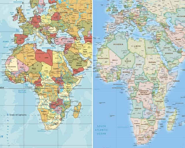
Nigeria and 163 other countries have supported an African-led resolution at the United Nations seeking more accurate global maps that better reflect the actual size of Africa.
The United Nations General Assembly adopted the resolution, titled “Correct the Map: Rebalancing Global Cartographic Representation and Promoting Equitable Representation of the World’s Regions, Particularly Africa,” by 164 votes to one, with six countries abstaining.
The United States was the only country to vote against the resolution, while Estonia, Georgia, Lithuania, Moldova, Serbia and Ukraine abstained.
The initiative, backed by the African Union, seeks to address long-standing concerns over the way conventional world maps depict Africa. Supporters argue that commonly used map projections can make Africa appear significantly smaller than its actual size.
Africa covers about 30 million square kilometres and is the world’s second-largest continent by both landmass and population.
Togo led negotiations on behalf of the African Group, advancing the AU-backed campaign for more balanced cartographic representation.
Togolese Foreign Minister Robert Dussey told the General Assembly that maps play an important role in shaping how people perceive the world.
He argued that maps influence education, imagination and collective understanding, making accurate representation important beyond technical cartography.
The resolution encourages the wider adoption of the Equal Earth projection and other equal-area map systems, particularly when comparing the sizes of continents and countries.
Developed in 2018, the Equal Earth projection is designed to preserve the relative area of geographical regions. Unlike the Mercator projection, it does not exaggerate the size of areas located farther from the equator.
Supporters of the resolution said the traditional depiction of Africa has contributed to what they described as the continent’s “symbolic minimisation” in the global imagination.
The resolution does not alter the geography of the world but seeks to change how geographical size is visually represented.
France supported the initiative and announced plans to reduce its reliance on the Mercator projection in its official world maps.
The United States, however, opposed the measure, maintaining that the General Assembly should concentrate on more urgent global challenges.
READ ALSO:
- Why EFCC Couldn’t Prosecute Atiku Over Alleged Fund Transfer – Ex-Lawmaker Agbonayinma
- Davido Mourns Associate Tiny, Who Died Following Botched Procedure In Thailand
- “If You’re At My Level, Say It Publicly” – Pete Edochie Tackles Rivals in Nollywood
- Ondo Deputy Governor Urges Inmates To Embrace Skills Acquisition For Better Life After Prison
- Osinbajo Raises Alarm as Wife’s Freshly Squeezed Orange Juice Tests Unsafe for Consumption
